


1630076 - STAPLETON CROSSING Voting District, Jefferson County, Georgia
About
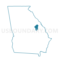
Outline

Summary
| Unique Area Identifier | 562296 |
| Name | 1630076 - STAPLETON CROSSING Voting District |
| County | Jefferson County |
| State | Georgia |
| Area (square miles) | 45.24 |
| Land Area (square miles) | 45.08 |
| Water Area (square miles) | 0.16 |
| % of Land Area | 99.65 |
| % of Water Area | 0.35 |
| Latitude of the Internal Point | 33.11030580 |
| Longtitude of the Internal Point | -82.47733820 |
Maps


Graphs
Select a template below for downloading or customizing gragh for 1630076 - STAPLETON CROSSING Voting District, Jefferson County, Georgia


Neighbors
Neighoring Voting District (by Name) Neighboring Voting District on the Map
- 1630081 - WRENS Voting District, Jefferson County, GA
- 1630082 - LOUISVILLE Voting District, Jefferson County, GA
- 1631460 - STAPLETON Voting District, Jefferson County, GA
- 1631593 - AVERA Voting District, Jefferson County, GA
Top 10 Neighboring County Subdivision (by Population) Neighboring County Subdivision on the Map
- Louisville CCD, Jefferson County, GA (6,096)
- Wrens CCD, Jefferson County, GA (5,179)
- Stapleton CCD, Jefferson County, GA (2,103)
Top 10 Neighboring Unified School District (by Population) Neighboring Unified School District on the Map
Top 10 Neighboring State Legislative District Lower Chamber (by Population) Neighboring State Legislative District Lower Chamber on the Map
Top 10 Neighboring State Legislative District Upper Chamber (by Population) Neighboring State Legislative District Upper Chamber on the Map
Top 10 Neighboring 111th Congressional District (by Population) Neighboring 111th Congressional District on the Map
Top 10 Neighboring Census Tract (by Population) Neighboring Census Tract on the Map
- Census Tract 9603, Jefferson County, GA (6,096)
- Census Tract 9601, Jefferson County, GA (5,179)
- Census Tract 9602, Jefferson County, GA (2,103)